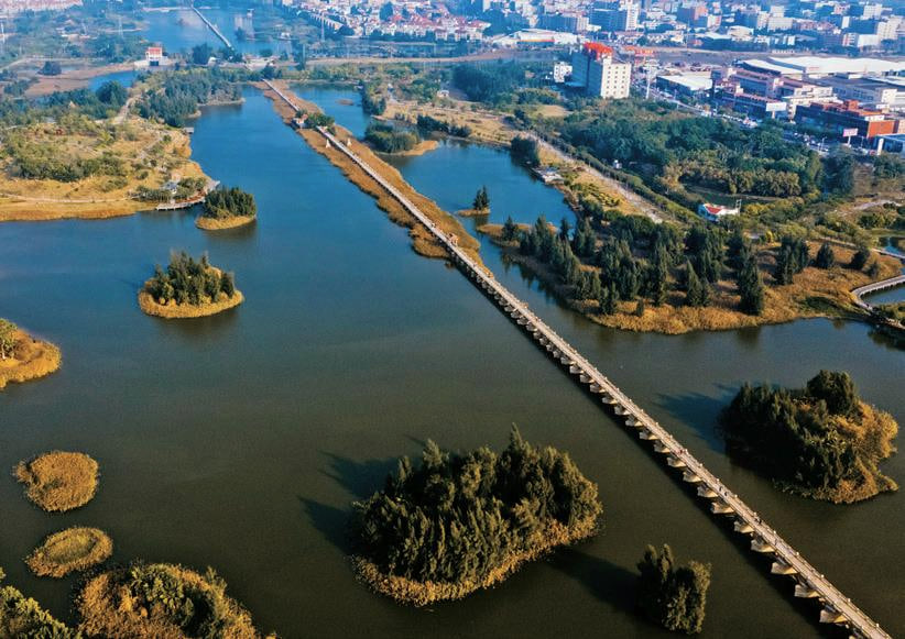
Aerial view of Anping Bridge crossing its wetland landscape

Historic bridge · Jinjiang / Nan'an

Anping Bridge

A 2.2-kilometre stone crossing that turned a tidal bay into a dependable southern route for people and goods.

Chinese map name
安平桥 Anping Bridge
Role in the port
Southern overland route and bay crossing
Historic period
Built 1128–1152, Southern Song
Time on site
Allow 1.5–2.5 hours

安平桥

How could one bridge enlarge the commercial territory of a port city?

Anping Bridge crosses the former bay between Anhai in Jinjiang and Shuitou in Nan'an, about 30 kilometres southwest of central Quanzhou. Built from 1128 to 1152, it carried the main road south towards Zhangzhou and Guangzhou. Its historical name Five Li Bridge refers to a traditional measure of length rather than a precise modern kilometre count.

The surviving structure extends roughly 2,255 metres and is carried on 360 stone piers. Rectangular, pointed boat-shaped and double-pointed piers respond to different water conditions, while granite beams between five and eleven metres long form the deck. Builders adapted methods already used at Luoyang Bridge to an even longer crossing.

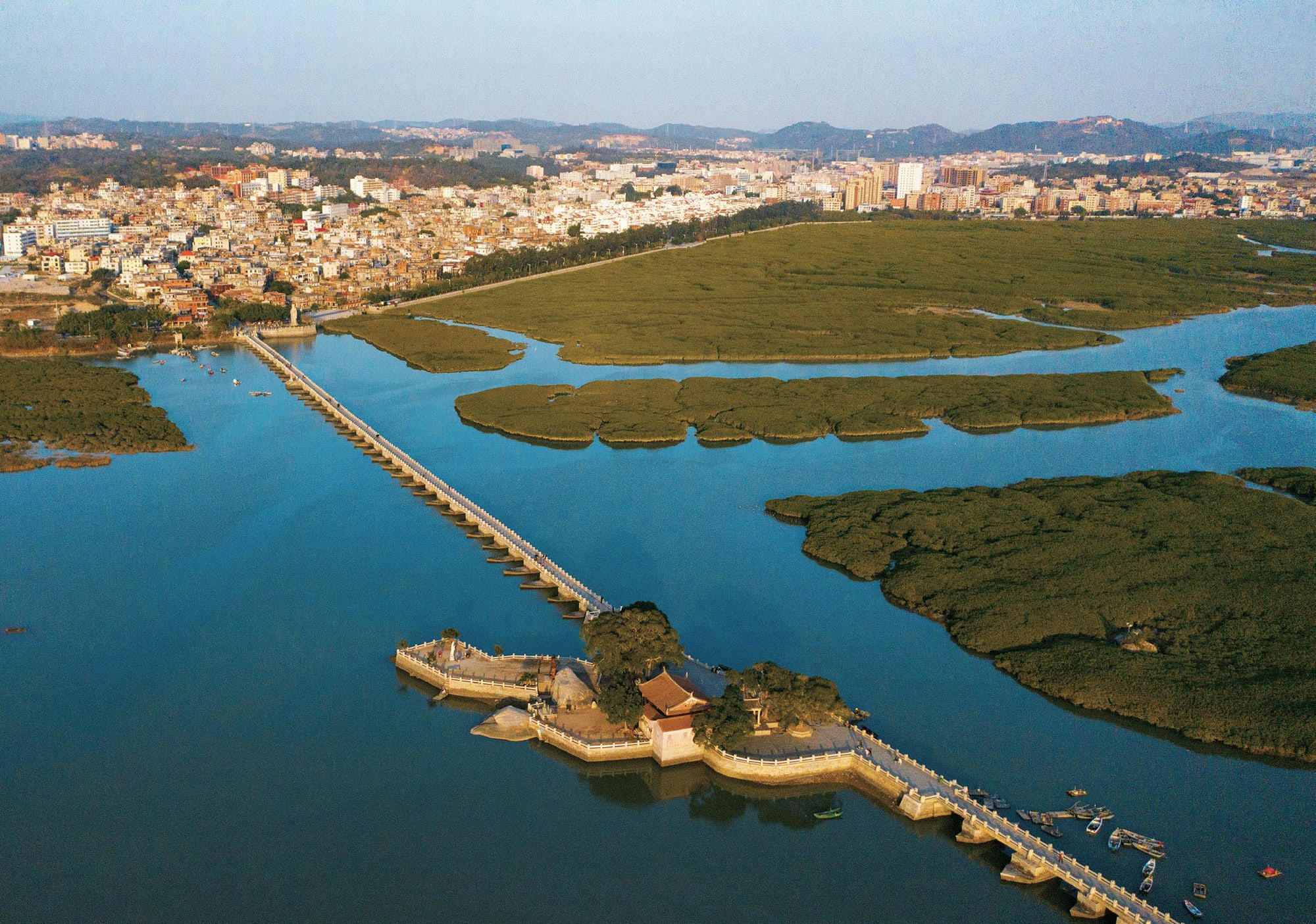
Anping was also a social landscape. Monks, merchants, officials and residents contributed to construction; pavilions, shrines, small pagodas, repair inscriptions and stone guardians served travellers along the route. Silting, reclamation and later repairs have changed the watery setting, so the bridge must now be read through both surviving masonry and a reconstructed coastal geography.
On site

What to look for

The site becomes more legible when you know which physical clues carry its larger story.

Start with the whole setting, then move closer. Architecture, archaeology and landscape often reveal different parts of the same argument.

Stone piers and tidal setting at Luoyang Bridge, whose engineering informed Anping Bridge

01

Three pier forms

Compare rectangular piers with one- and two-ended boat shapes. Their distribution responds to currents and foundation conditions rather than decorative preference.

02

The scale of the granite beams

Long monolithic slabs span the piers. Their quarrying, transport and placement reveal the organisational ambition behind what appears to be a very low bridge.

03

Pavilions and repair steles

Water Heart Pavilion and the surviving inscriptions show how travellers used the crossing and how later communities repeatedly maintained it.

04

The lost breadth of the bay

Wetlands and reclaimed ground do not reproduce the 12th-century waterway. Look along the bridge's full line and imagine why such a long structure was necessary here.

Aerial view of Anping Bridge crossing its wetland landscape

Read the port system

Road infrastructure moved the port beyond its shoreline

Hugh Clark's regional research links the Song surge in bridge building with expanding markets and the collection and distribution of goods. Anping made the southern route more predictable for merchants, officials and local producers.

Its construction was collective rather than a single heroic act. Religious institutions, commercial wealth, government authority and community labour converged in the same public work, mirroring the wider systems that sustained Quanzhou's maritime economy.

See all 22 component sites

Research lens

What scholarship adds to the visit

Anping Bridge demonstrates the southern reach of Quanzhou's overland network and how monumental public works reduced friction between the port and regional markets.

01

The port system extended towards Zhangzhou and Guangzhou

The nomination interprets the long crossing as a principal southern route, linking Quanzhou with production areas and coastal connections beyond the city.

Read the source

Quanzhou World Heritage nomination dossier (2020)

02

Bridges belong to maritime archaeology

Pearson, Li and Li treat overland links, river transport, docks and shipwrecks as one archaeological field. Anping is maritime heritage because cargo had to reach and leave the water efficiently.

Read the source

Richard Pearson, Li Min and Li Guo, ‘Quanzhou Archaeology: A Brief Review’ (2002)

03

Today's landscape is not the medieval waterway

ICOMOS warns that altered settings can reduce the legibility of serial sites. Reclamation, silting and modern development mean visitors must reconstruct why this low stone bridge once crossed a much more maritime environment.

Read the source

ICOMOS evaluation of the revised Quanzhou nomination (2021)

Plan the visit

Make the time on site count

These are planning decisions, not fixed opening-hour claims. Recheck access and transport shortly before travel.

01

Walk a meaningful section

The full crossing is long. Allow enough time for the central pavilion, piers and views rather than treating the first 100 metres as the whole site.

02

Protect against sun and wind

Much of the deck is exposed. Bring water, sun protection and secure footwear, and avoid the hottest hours in summer.

03

Choose the correct entrance

Pins may lead to Anhai, Shuitou or adjacent park areas. Save 安平桥 and confirm where a driver will collect you after the walk.

04

Check current walking access

Maintenance, weather and crowd control can change how much of the bridge is open. Follow barriers and current notices rather than an old route description.

Connect the place

Make the bridge the anchor of a Jinjiang day

Combine Anping with Cao'an or an Anhai stop, leaving realistic road time between them. For an engineering comparison, visit Luoyang Bridge on a separate north-of-city outing.