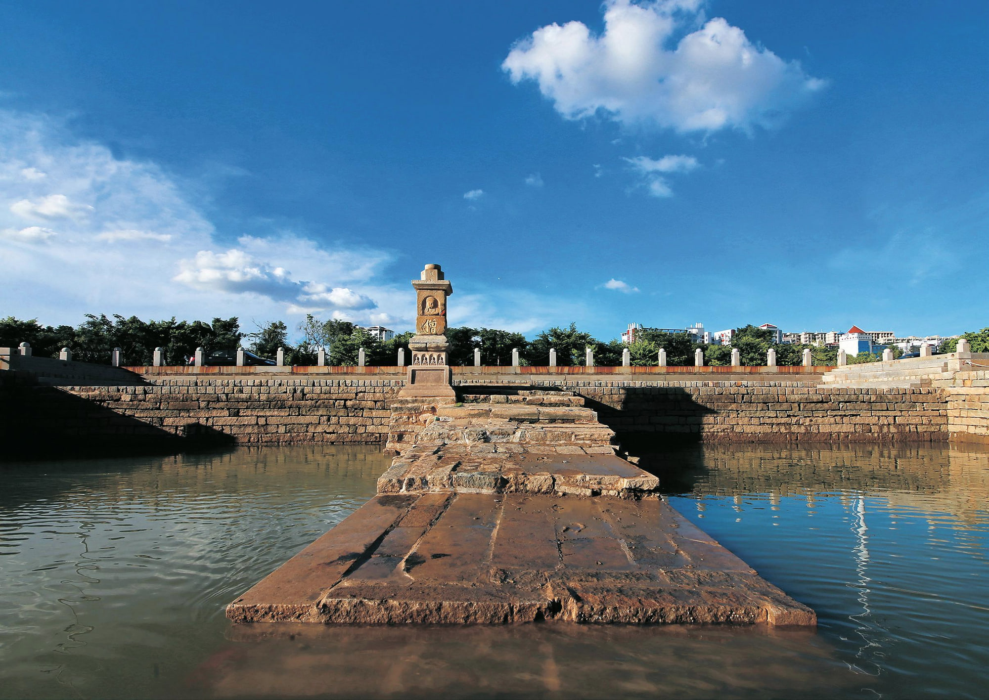
Historic stone dock structures extending into the Quanzhou estuary

Port archaeology · Jin River estuary

Estuary Docks

Two different stone landings show how small boats, large vessels, high tide and low tide were handled inside Fashi Port.

Chinese map name
江口码头 文兴码头 美山码头
Role in the port
Water–land transfer at an inner port
Historic period
Built from the Song–Yuan era; used into the 20th century
Time on site
Allow 1.5–2 hours for both docks

江口码头

How did boats with different drafts transfer cargo along a tidal river?

The Estuary Docks comprise Wenxing and Meishan docks on the north bank of the Jin River, about 1.1 kilometres apart. Along with Zhenwu Temple and remains of a Song ship, they preserve the landscape of Fashi, a major inner port southeast of Quanzhou's old city.

Wenxing Dock sits upstream in shallower water. Its gently sloping stepped form extends more than 30 metres into the river, allowing small boats to berth even at low tide. Meishan lies downstream in deeper water and uses steeper platform piers that were more accessible to larger ships at high tide.

The difference between them is the main interpretive clue. A port did not need one monumental quay to handle every vessel. Multiple landings adapted to water depth, tide and boat size, then connected cargo with roads and river routes towards the city.
On site

What to look for

The site becomes more legible when you know which physical clues carry its larger story.

Start with the whole setting, then move closer. Architecture, archaeology and landscape often reveal different parts of the same argument.

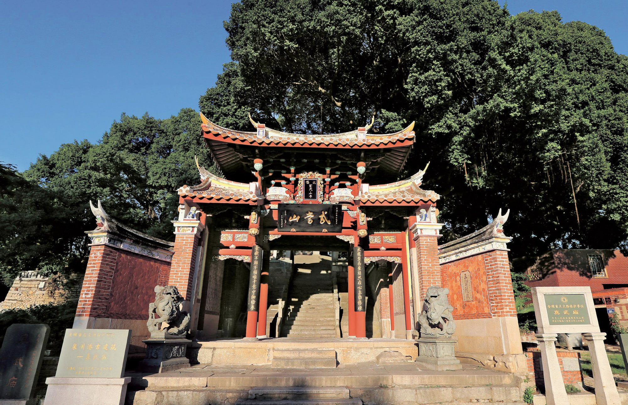
Zhenwu Temple above the former Fashi inner port near the Estuary Docks

01

Wenxing's gentle stepped slope

Follow how the landing reaches towards shallow water. The gradual profile made transfer possible as the tide fell.

02

Meishan's steeper platforms

The downstream dock responds to deeper water and larger vessels. Compare level changes rather than expecting the two docks to share one design.

03

Granite slab masonry

Stone courses withstand repeated wetting, load and impact. Distinguish historic fabric from modern paths, railings and river works.

04

The river as moving infrastructure

Tide, current and sediment affected when and how each dock worked. The water is part of the mechanism, not just a scenic background.

Historic stone dock structures extending into the Quanzhou estuary

Read the port system

Quanzhou used a distributed chain of landings, not one central pier

Fashi's docks transferred goods between river craft, seagoing vessels and land routes. Their relationship with Zhenwu Temple and the old city demonstrates how practical movement, ritual and urban access overlapped along the inner port.

Ship archaeology strengthens that picture. A late-Southern-Song hull found in the Quanzhou harbour area had 12 bulkheads creating 13 compartments, sophisticated multi-layered planking and construction suited to ocean travel. Docks and ships are more informative when read together.

See all 22 component sites

Research lens

What scholarship adds to the visit

The Estuary Docks place cargo transfer at the centre of the story: they are where riverbank, tide, stonework and movement between boat and city met.

01

A group of docks, not one monumental quay

The nomination treats the Meishan and Wenxing dock remains as connected elements at the Fashi inner-port area. Their modest scale reflects repeated points of landing and transshipment rather than a modern container terminal.

Read the source

Quanzhou World Heritage nomination dossier (2020)

02

Ship and shore evidence must be read together

Pearson, Li and Li discuss Fashi and Houzhu ship finds alongside docks and river routes. This combined evidence is stronger than treating a stone landing place in isolation.

Read the source

Richard Pearson, Li Min and Li Guo, ‘Quanzhou Archaeology: A Brief Review’ (2002)

03

Waterfront heritage remains environmentally exposed

ICOMOS identifies the Estuary Docks among components vulnerable to climate change, flooding and storms. Their significance therefore includes the continuing physical conditions of the river edge.

Read the source

ICOMOS evaluation of the revised Quanzhou nomination (2021)

Plan the visit

Make the time on site count

These are planning decisions, not fixed opening-hour claims. Recheck access and transport shortly before travel.

01

Treat the docks as two stops

They are about 1.1 kilometres apart and have different forms. Save both Chinese names rather than assuming one map pin represents the entire component.

02

Notice the tide

Water level changes what is visible and explains the contrasting designs. Check a local tide forecast for interpretation, while still following access and safety notices on site.

03

Use transport from downtown

A taxi or ride-hailing car is more practical than adding the docks to a central walking route. Arrange the sequence with Zhenwu Temple before setting out.

04

Keep back from wet stone

Algae, mud and tidal surfaces can be slippery. Use designated viewpoints and do not step onto exposed dock masonry where access is restricted.

Connect the place

Build a Fashi port-landscape half day

Visit Zhenwu Temple, Wenxing Dock and Meishan Dock as one group. Add the Maritime Museum separately if you want to connect these shore structures to the preserved Song ship.